
A Coast Path Walk: To Barrett’s Zawn and Back
Following the South West Coast Path from Port Isaac Towards Tintagel
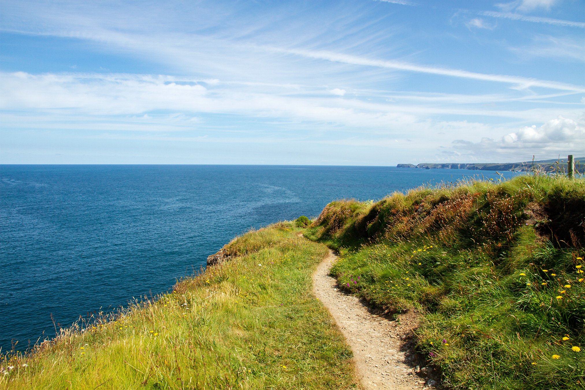
The stretch of South West Coast Path heading northeast out of Port Isaac towards Tintagel Head and beyond is wild, beautiful, and can be quite hard work!
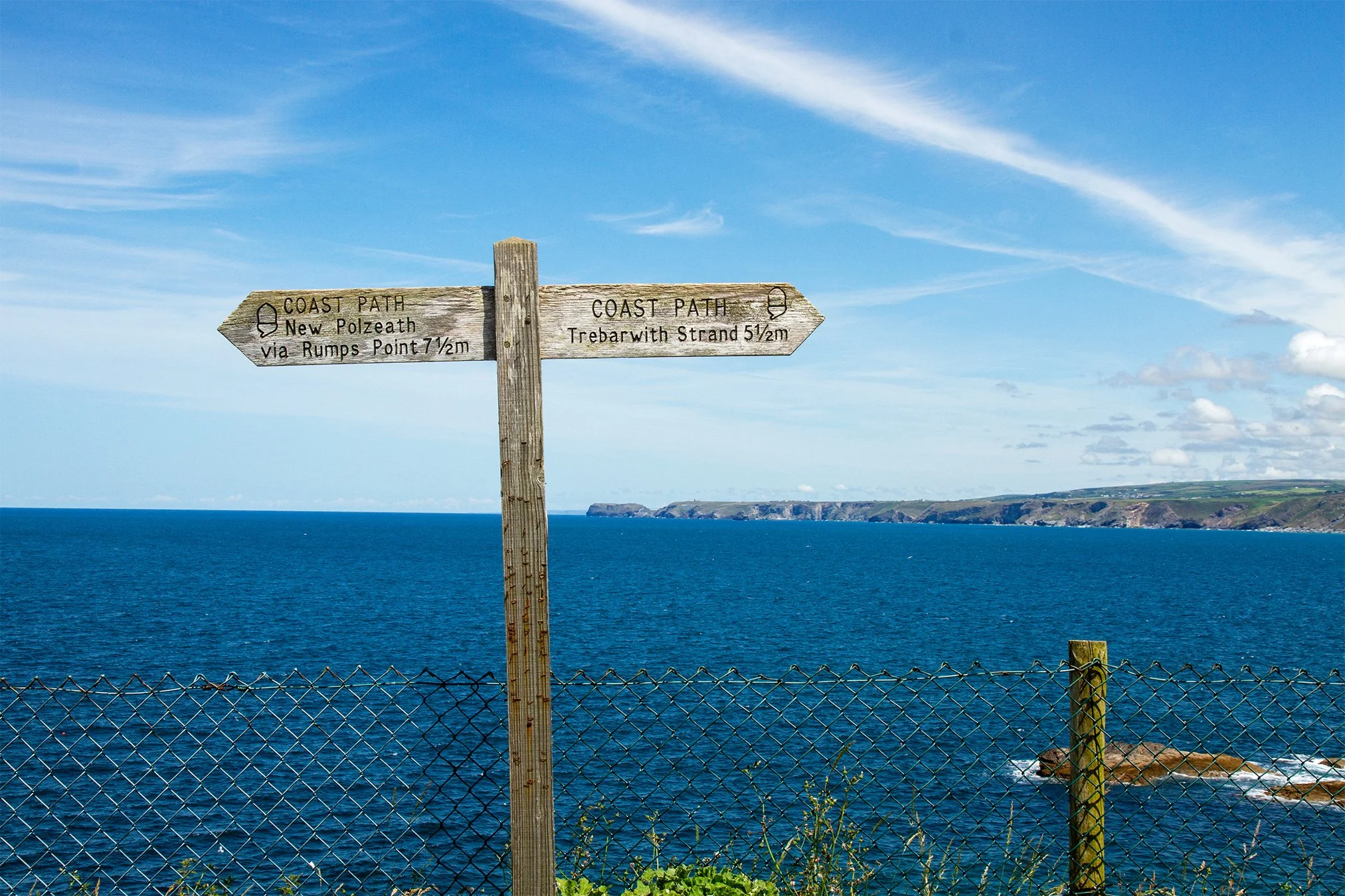
Unlike other sections that can be shortened or turned into circular loops, this more remote stretch of coast is a straight hike to the next nearest settlement at Trebarwith Strand, five and a half miles away. You could always catch the number 96 bus from Port Isaac to Tintagel (50 mins) and walk the 9 miles back, but it is a long and challenging hike!
The South West Coast Path from Port Isaac: The choice is yours!
Therefore, we’d suggest walking from Port Isaac two and a half miles along the coast path to Barrett’s Zawn, before turning around and retracing your steps back again to make a five-mile walk. This way, you also have the option of shortening your walk by turning around at any point you wish.
Using our booking office on New Road as a starting point, walk down New Road and follow the road around the corner, past the car park overlooking Port Isaac Bay, and head down the hill to Port Gaverne.
As you walk up the road on the other side of Port Gaverne there is a small flight of steps to your left. Take these and walk out along The Main, before picking up the coast path to the right (just before the narrow section with the steep steps down to the left to Tag’s Pit). The path traces the edge of the cliff before striking out along the clifftop to Cartway Cove, at which point the path cuts back in to connect with the coast road. You could skip this section by simply following the road up out of Port Gaverne, but the views are beautiful and there are some nice benches to stop at and take it all in.
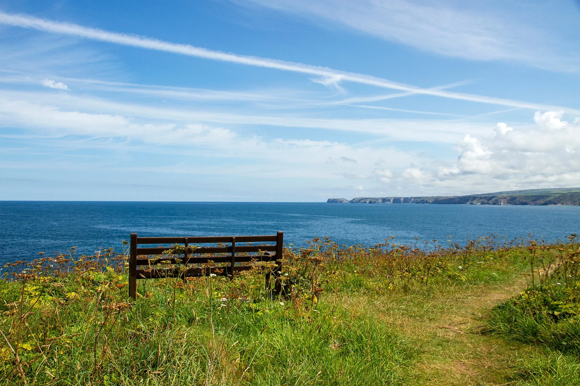
Stop here for a minute to soak it all in
When you meet the coast road, cross the slate stile, head twenty meters or so along the road to the driveway to a property called Silver Spray, and walk up the drive. The coast path restarts just past the house, heading through a small meadow and out along the clifftop. The cliffs that you’ll be walking above are high and in the early summer months they are the nesting sites of hundreds of pairs of breeding seabirds – fast, swooping fulmars who glide on the updrafts and then hundreds of black-and white razorbills and guillemots that you can watch dropping from their nests and then flying low out to sea in search of food before returning the same way they came to feed their young.
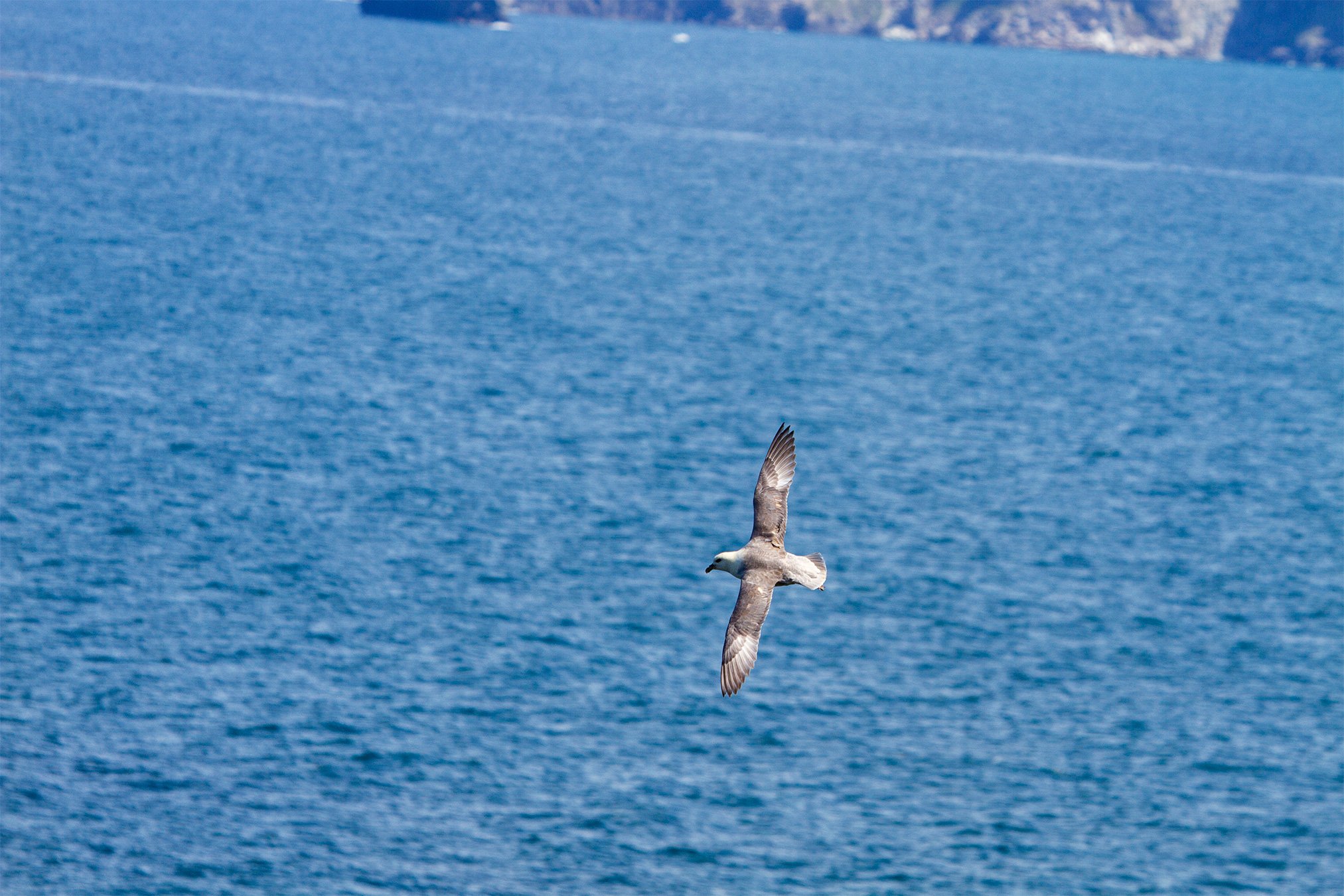
A juvenile fulmar gliding on the updrafts at Bounds Cliff
The highest point on the coast path here is Bounds Cliff, at 130m/420 feet above sea level. We did say it was a challenging walk! Descending the other side you eventually drop down to the valley at the back of Barrett’s Zawn, a now inaccessible rocky beach where slate used to be quarried, with a long since unused tunnel through the cliff up which donkey’s used to haul the cut slates.
Barrett’s Zawn is two and half miles along the coast path from Port Isaac, which given the more challenging nature of this section is a good point at which to turn around. As you head back to Port Isaac you can enjoy the views of the approaching village, and Varley Head and the coastline beyond to the southwest, before enjoying a well-earned drink in the sunshine beneath the hanging baskets outside the Port Gaverne Hotel.

Walking back towards Port Isaac
This is a reasonably quiet section of the coast path because of how long and “remote” it is. It offers incredible views, some great opportunities to spot seabirds, and the sort of wonderful solitude that so many seek when walking the coast path.