
Port Isaac Walks: Around Lobber Point (Circular Walk)
Distance: 1.3 miles/2.2 km
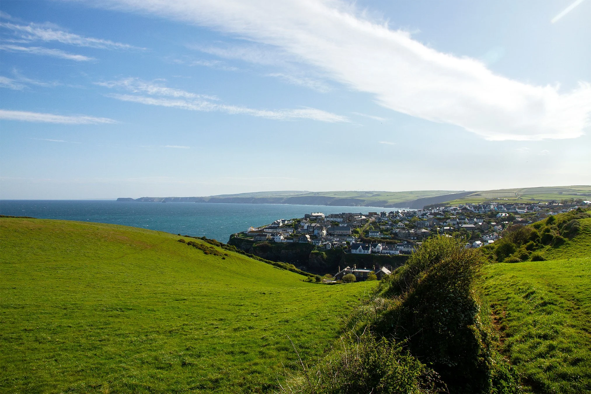
The classic view of Port Isaac is looking down upon the harbour and the village from Lobber – the hilltop and headland on the west side of Port Isaac. Whilst many visitors enjoy the walk up Roscarrock hill and on to Lobber to look back upon the village, it can also be the start of a really nice and relatively short circular walk around Lobber Point, and we’d certainly encourage you to do it during your visit.
Starting from The Platt at the top of the beach, take the right turn on the other side of the fish cellars, and walk up Roscarrock Hill past the old Methodist Chapel, The White House and White House Cottage, Fern Cottage (“Doc Martin’s House) and Folly 1.
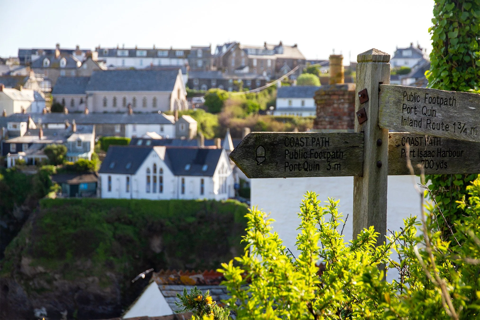
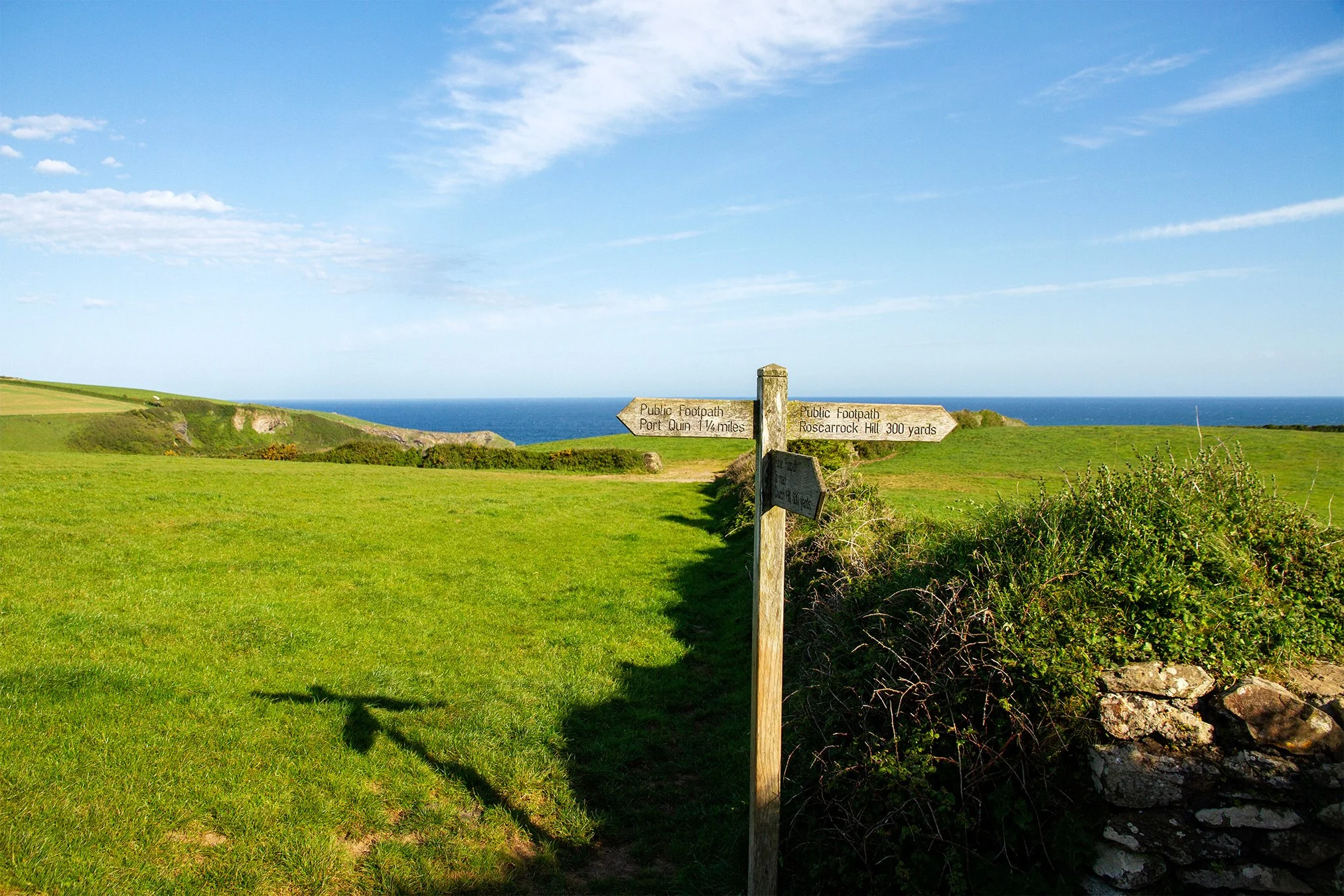
At the top of the paved road, you have a choice of which way you’d like to complete the circuit. We’d suggest walking it clockwise to enjoy the view of Port Isaac coming back around Lobber. If you choose to do it this way, just past Folly 1 there is a signpost on the left and a footpath disappearing up through the bushes. Head up this hill. The path crosses a style and continues uphill following the edge of a field. At the top of the hill you will emerge into the field, with fantastic views behind you of Port Isaac village and Port Isaac Bay stretching away up to Tintagel. You will come to a style, with a signpost on the other side of it.
Cross the style, and follow the path either to your left and then right down the boundary wall , or you can walk diagonally across the field (a “10-clock” bearing).
This field used to have a pole in the middle of it, known as a “wrecking post” that the local coastguard used to use for training in the late 19th and early 20th centuries. The post was used to simulate the mast of a wrecked ship and allowed them to practice breeches buoy rescues, whereby the coastguard would use a mortar rocket to fire a line to a stricken ship. Once secured, a large pair of tough canvas shorts (breeches) attached to a buoyant life ring could be attached to the line like a zip wire and used to rescue survivors.
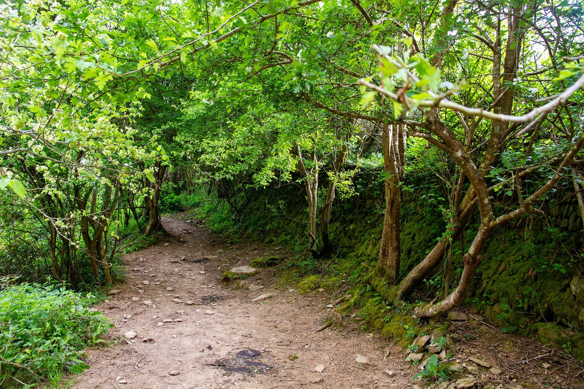
Once you reach the far corner of this field, and the gate at the end of the Cornish stone wall, cross straight across and follow the path down through the bushes. In spring this can become a bit overgrown, but often the cows moving along it keep it open!
At the bottom of this path you will come to the stream. As of spring 2026 there is a rope swing here, and a tree that was blown over in Storm Gorretti has knocked over the footpath signpost. There is a small bridge over the stream, but we are turning right, keeping the stream on our left hand side, and following the path down the valley back towards the sea.
At the end of the path the valley opens out into a small meadow area, with the small rocky cove of Pine Haven (locals have always called it “Pine Awn”) in front.
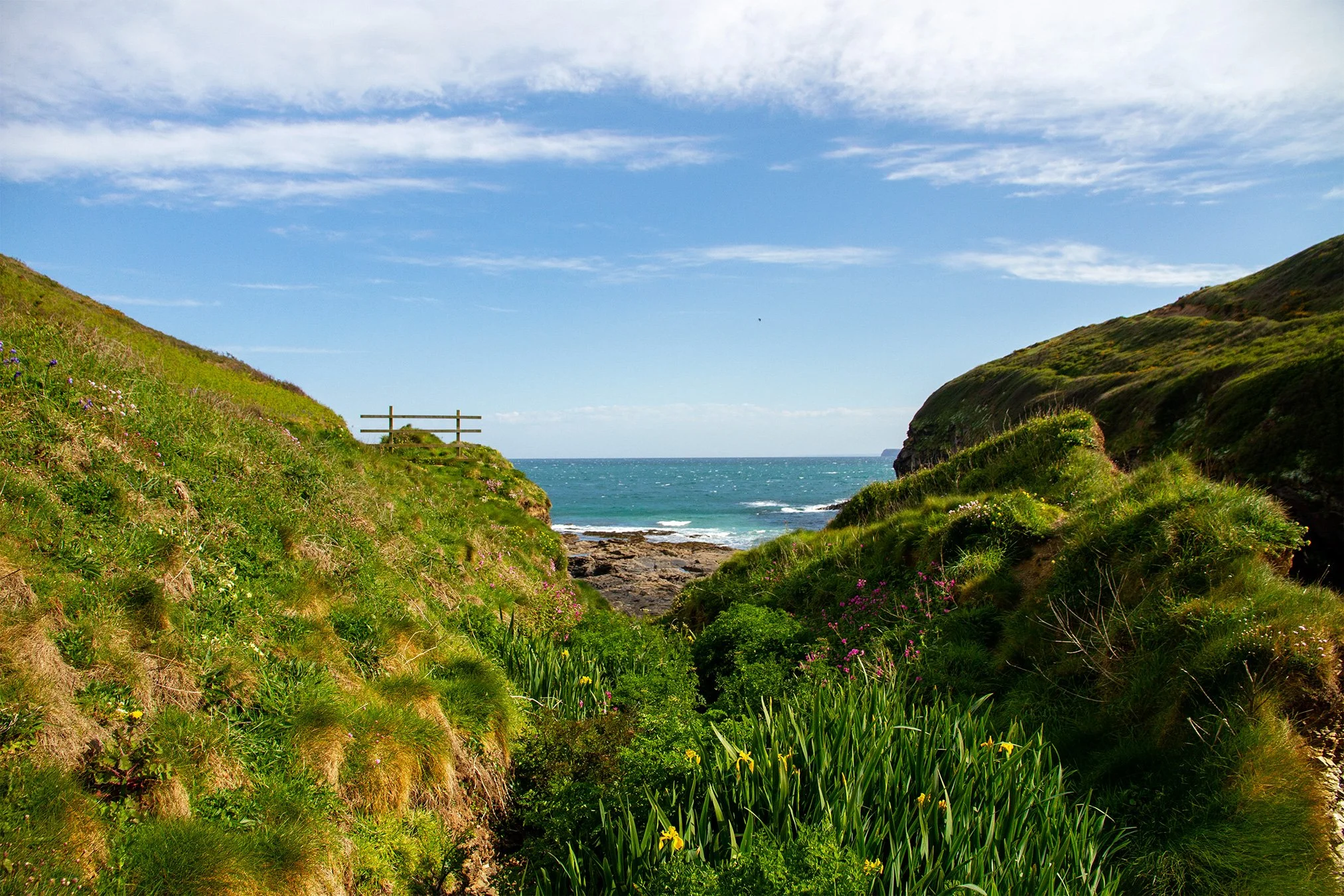
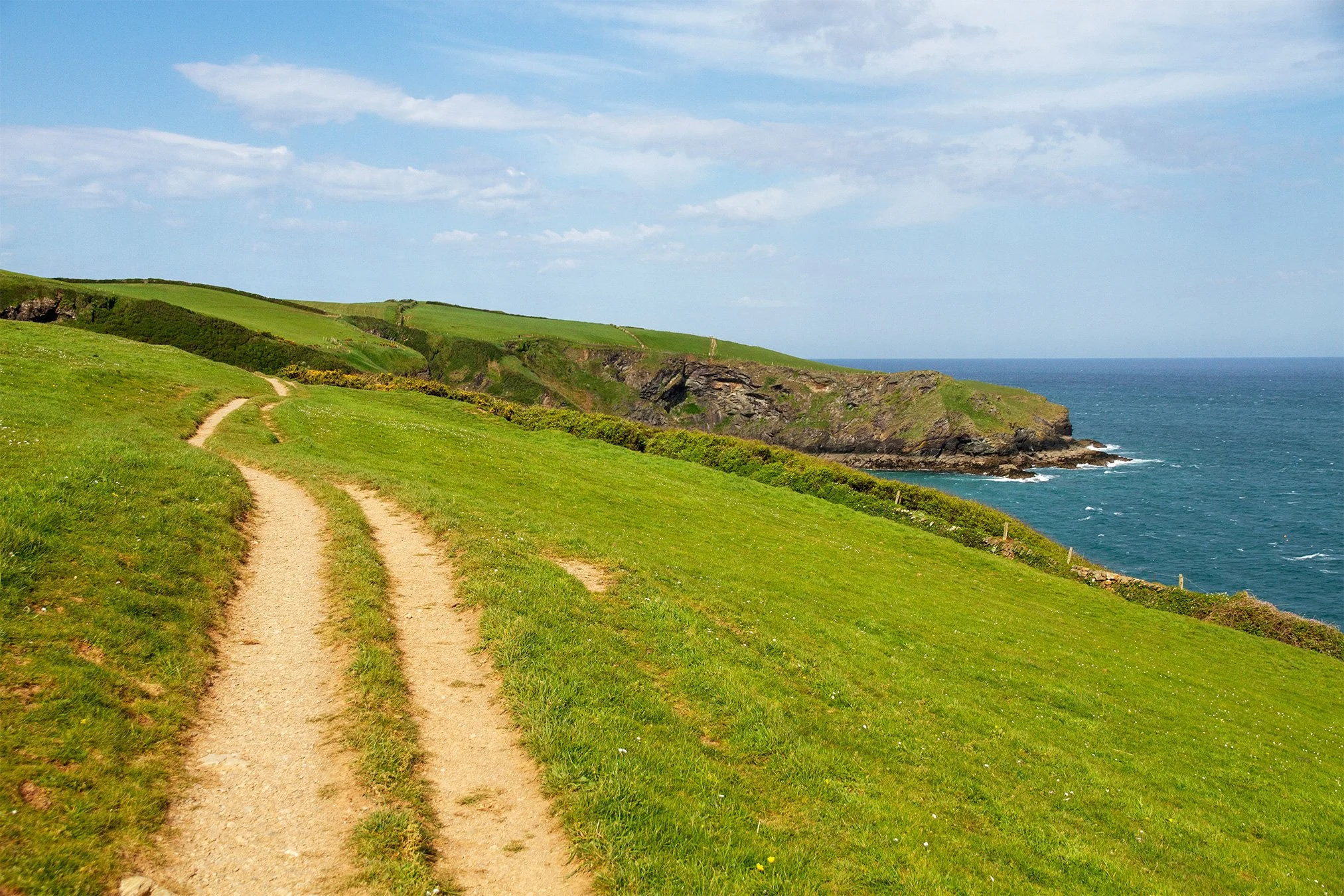
Turn right up the hill, back towards Lobber point, and follow the obvious path up and around. As the path heads around Lobber you can look back, past Pine Haven to Varley Head beyond it. To your left is the expanse of Port Isaac Bay with Tintagel Head visible in the distance up the coast. The path bears around to the right and goes through a large gap in the hedge, into Lobber field.
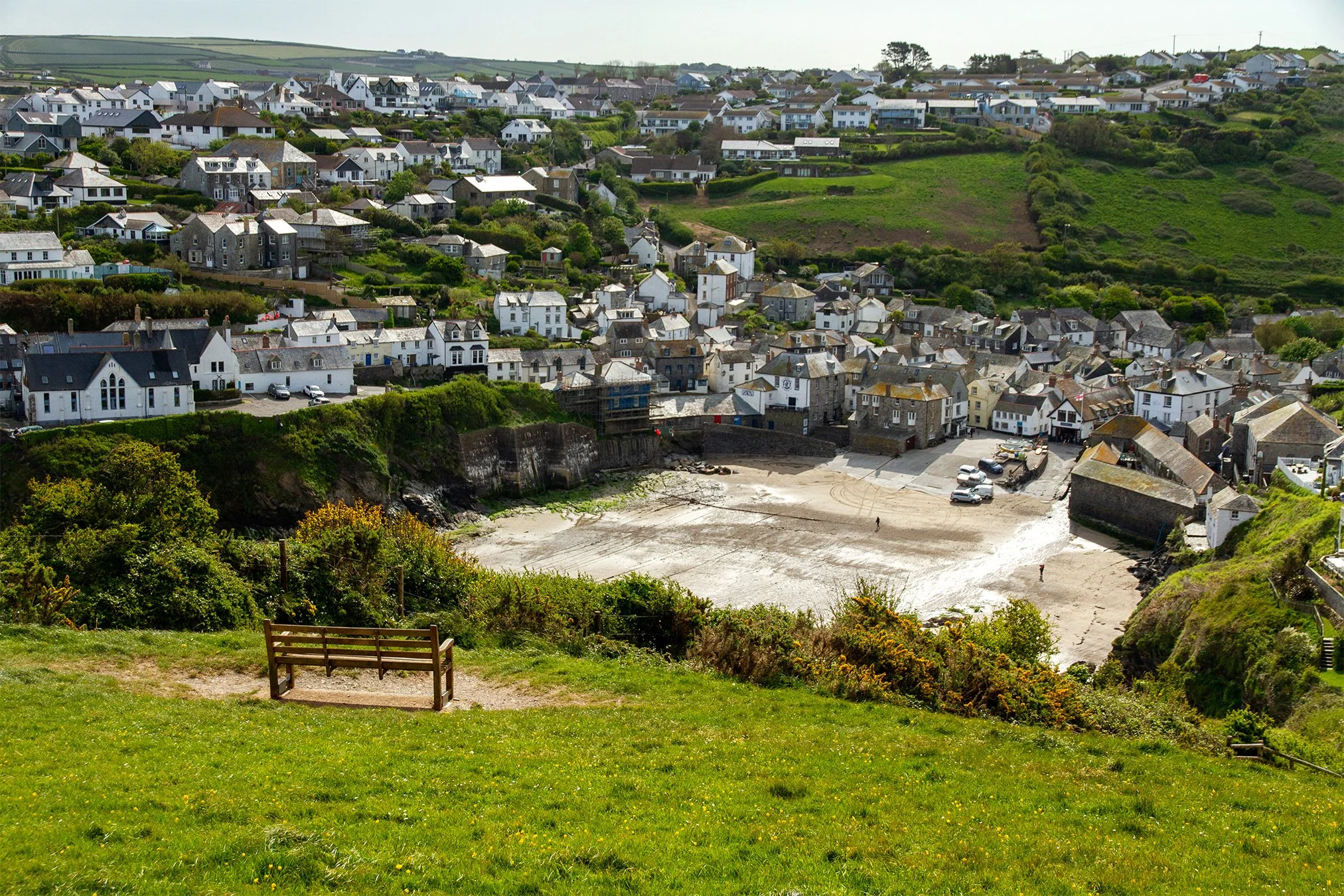
From here you can enjoy another wonderful view of Port Isaac and the harbour, before heading down the steps and through the gate at the bottom. This path leads you along the top of the allotments and across the front of Khandallah, the row of three large Victorian properties, and back to the top of Roscarrock Hill.
From here you can walk back down Roscarrock Hill to your starting point, perhaps in time for a bite to eat.